
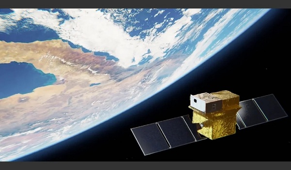
On the occasion of World Environment Day, ISRO informed about its collaborative effort with French National Space Agency CNES for the upcoming Thermal Infrared Imaging Satellite for High-resolution Natural Resource Assessment (TRISHNA) mission.
TRISHNA Mission
- TRISHNA mission is a collaborative effort between ISRO and National Centre for Space Studies (CNES).
- Two primary payloads have been installed in this satellite mission.
- Thermal Infra-Red (TIR) Payload: It is a four-channel long-wave infrared imaging sensor capable of high-resolution mapping of surface temperature and emissivity. It has been developed by CNES.
- Visible-Near Infrared-Short Wave Infrared (VNIR-SWIR) payload: It consists of seven spectral bands designed for detailed mapping of surface reflectance to yield important biophysical and radiation budget variables. This payload has been developed by ISRO.
- It is planned to operate in a sun-synchronous orbit at an altitude of 761 km from the earth.
- The mission is designed for an operational period of five years and will provide a spatial resolution of 57 m for land and coastal areas and 1 km for oceanic and polar regions.
- Mission objective: Detailed monitoring of the energy and water budgets of the continental biosphere to quantify terrestrial water stress and water use and to provide high-resolution observations of water quality and dynamics in coastal and inland waters.
- It will provide spatial and temporal high-resolution monitoring of Earth’s surface temperature, emissions, biophysical and radiation variables for surface energy budgeting at regional to global scales.
- Apart from this, the mission will also help in comprehensive assessment of urban heat islands, detection of thermal anomalies associated with volcanic activity and geothermal resources, and accurate monitoring of snowmelt runoff and glacier dynamics.
- The mission will also provide valuable data related to aerosol optical depth, atmospheric water vapor and cloud cover.
Significance of the mission
- Helpful in assessing irrigation water use and increasing crop water productivity through efficient and sustainable water management practices and better micro-watershed management.
- Assist in climate monitoring by tracking key indicators such as drought, permafrost changes and evaporation-emission rate.
- Water quality monitoring will help detect pollution in coastal and inland water bodies.
- Identify sub-sea groundwater discharge along the coastlines.
- Contribute to improved hydrological models by evaluating snow cover and ice melt patterns through cryosphere monitoring.
- Use of TRISHNA data in several global initiatives.
- These initiatives include GEOGLAM for Agricultural Monitoring, UN Sustainable Development Goals and Global Water Watch.
Group on Earth Observations Global Agricultural Monitoring
- The Group on Earth Observations Global Agricultural Monitoring (GEOGLAM) initiative was launched by G-20 agriculture ministers in June 2011 and reaffirmed in January 2017.
- It is an international programme aimed at increasing the use of earth observations to strengthen decision making, action and policy in food security and sustainable agriculture.
- The GEOGLAM initiative is part of the G-20 Action Plan on Food Price Volatility. Global Water Watch
- It is a data platform that provides free and globally accessible information on the amount of water stored in reservoirs and water levels and flows in major river systems around the world.
- It uses modern AI and Earth observation (EO) algorithms to map dams and generate high-resolution spatial and detailed information in near real-time.
- It is a partnership between Deltares, the World Resources Institute (WRI) and the World Wildlife Fund (WWF).