
Tropical Cyclone Doxuri developed in the western Pacific Ocean to the east of the Philippines. Its speed is 54 km/h – 231 km/h. It has caused heavy rains and storms in southern China affecting more than one million people. Landslides have affected about 400,000 people in southern Fujian province. The Japanese Meteorological Agency officially named the storm as Doksuri, which is a Korean word. Tropical cyclones are known by different names in different places, such as typhoon (western Pacific), hurricane (North Atlantic and central and eastern North Pacific), or cyclone (South Pacific and Indian Ocean) .
Tropical cyclone
- The center of low air pressure surrounded by circular isobaric lines generated between the Tropics of Cancer and Capricorn is known as tropical cyclone.
- There is considerable variation in their size, as their diameter ranges from 50 km to 300 km.
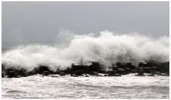
- The air pressure in the center of a cyclone is less than 650 millibars. With the intensification of the isobars, the wind speed becomes more than 120 kilometers per hour.
- Cyclones generally move from east to west with the trade winds (trade winds).
- On the basis of wind speed, the World Meteorological Organization (WMO) classifies low pressure centers surrounded by isobars as tropical depressions (less than 16 m/s) and tropical storms (16 m/s to 32 m/s). up to .) and tropical cyclone (speed above 32 m/s).
- These occur in the summer, when the sea surface temperature is at least 27 °C.
- For their occurrence, it is necessary to have a high value Coriolis force.
- It does not originate near the equator, but when the displacement of the Inter-Tropical Convergence Zone occurs on the surface of the tropical ocean during the summer season, then areas suitable for the origin of the cyclone develop. .
- Tropical cyclones originate in the absence of a jet stream in barotropic atmospheric conditions during summer.
- The eye of the cyclone represents the center of the cyclone, where the temperature is maximum and air pressure is minimum and the sky is almost cloudless.
- Eye wall is an area with highest wind velocity, where there is heavy rainfall accompanied by lightning.
- Precipitation, the Rain Spiral Band, extends around the wall of the eye. The region receives relatively little rainfall.
- With relative humidity being relatively low in the Annular Zone, adverse conditions for rain remain.
- Due to regional effect in the outer convective belt, rapid convective rain occurs along with lightning.
temperate cyclone
- A temperate cyclone is formed by the convergence of two opposite nature cold and warm air. That’s why it is called ‘Vatagri Cyclone’. Their area is found in both the hemispheres between 35-65° latitude.
- Temperate cyclones are circular, semi-circular or oval in shape, with low pressure in the middle. Sometimes its shape becomes like the letter ‘V’.
- The winds moving from the periphery towards the center of the cyclone, instead of reaching the center directly, cut the isobaric lines at an angle of 20° to 40° due to Coriolis force and frictional force.
- Generally these cyclones move from west to east but they do not have any fixed path.
- In the temperate cyclones that originate over the Mediterranean Sea, some cyclones pass through Pakistan and reach north-west India. Here they are called Western Disturbances.
- Due to the cyclone coming from the west, the velocity of the wind slows down. Due to this there is an increase in temperature and specific humidity with a decrease in air pressure. Also, the wind direction starts changing from east to southeast.
- With the arrival of a warm front, rainfall occurs at a slow rate over a wide area for a long period of time.
- The arrival of the warm sector is due to the advance of the warm front. With the change in the wind direction, the temperature and specific humidity increase. Also, the sky becomes clear without clouds.
- With the arrival of the cold front after the passing of the warm zone, not only does the temperature decrease, but the cloud cover starts again. On the cold front, it usually rains with lightning-thunder in a limited area for a short period of time.
- The cold zone is soon followed by the passing of the cold front. With the rapid decrease in temperature, not only does the air pressure increase, but the sky becomes cloudless and clear.
- Due to the development of adversary front due to meeting of cold front with warm front, the front eventually decays.