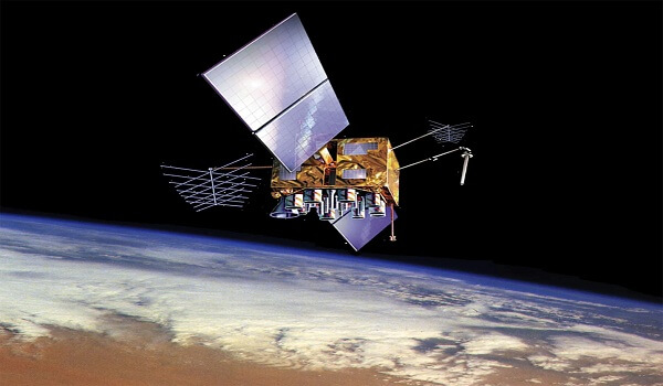
Global Positioning System (GPS) is one of few everyday technologies that have had the kind of revolutionary impact on civilian, military, scientific, and urban realms, redefining our sense of location and impacting diverse sectors globally.
Global Positioning System
- The GPS, initiated by the U.S. Department of Defense in 1973, comprises three main segments,
- Space: Detailing the space segment, the 24 satellites in six orbits ensure global coverage, allowing receivers to access signals from at least four satellites simultaneously—a fundamental necessity for accurate positioning.
- All six orbits are positioned at an altitude of 20,200 km above the Earth, and each orbit has four satellites at all times. Each satellite completes two orbits in a single day.
- Control: The control segment, managed by ground-based stations, ensures satellite performance and signal accuracy, adhering to the Standard Positioning Service (SPS) standards published in 2020. Key stations across the globe manage and monitor the system’s integrity.
- The SPS standard tells application developers and users anywhere in the world what they can expect from the GPS system.
- User: User segment encompasses diverse sectors from agriculture to military operations, with an estimated 6.5 billion GNSS (Global Navigation Satellite System) devices worldwide in 2021, expected to surge to 10 billion by 2031, underscoring its pervasive influence.
Functionality of GPS
- GPS operates through satellite-transmitted radio signals at specific frequencies (L1 and the L2 frequencies at 50 bits/second), received and triangulated by GPS receivers, enabling precise location determination in three dimensions of space and one of time.
Precision and Adjustments
- Error adjustments, including relativistic effects on satellite clocks and relative velocities, are factored in to enhance accuracy, highlighting the meticulousness of GPS calculations.
- Satellites maintain precise time for GPS by using atomic clocks. These clocks are critical because even tiny timing differences could lead to substantial location errors.
Do Other Countries Have GNSS
- Several countries operate their own Global Navigation Satellite Systems (GNSS) alongside the GPS. Such systems are currently operated by Australia, China, the European Union (EU), India, Japan, South Korea, Russia, and the U.K.
- Of these, Russia’s GLONASS, the EU’s Galileo, and China’s BeiDou systems are global.
- India mooted its own Indian Regional Navigation Satellite System in 2006, later rechristened Navigation with Indian Constellation (NavIC). Its space segment consists of seven satellites: three in geostationary orbits and four in geosynchronous orbits.
- As of May 2023, the minimum number of satellites (four) could facilitate ground-based navigation. The master control facilities are located in Hassan in Karnataka and Bhopal in Madhya Pradesh.
- The NavIC satellites use rubidium atomic clocks and transmit data in the L5 and the S bands, with newer satellites also transmitting in the L1 band.
- India also operates the GPS-Aided Geo Augmented Navigation (GAGAN) system, which was developed and established by the Indian Space Research Organisation (ISRO) and the Airports Authority of India.
- GAGAN’s primary purpose is “safety-of-life civil aviation applications catering to the Indian airspace” and for providing “correction and integrity messages for GPS”.

